Our Projects
Explore our portfolio of successful surveying and mapping projects across Lebanon. Each project demonstrates our commitment to precision, innovation, and client satisfaction.
Featured Work
Showcasing our expertise across various surveying disciplines and project scales

.jpg)
Excavation Topographic Survey Control
Precise topographic survey and control for excavation project including elevation monitoring, cut/fill calculations, and construction staking.
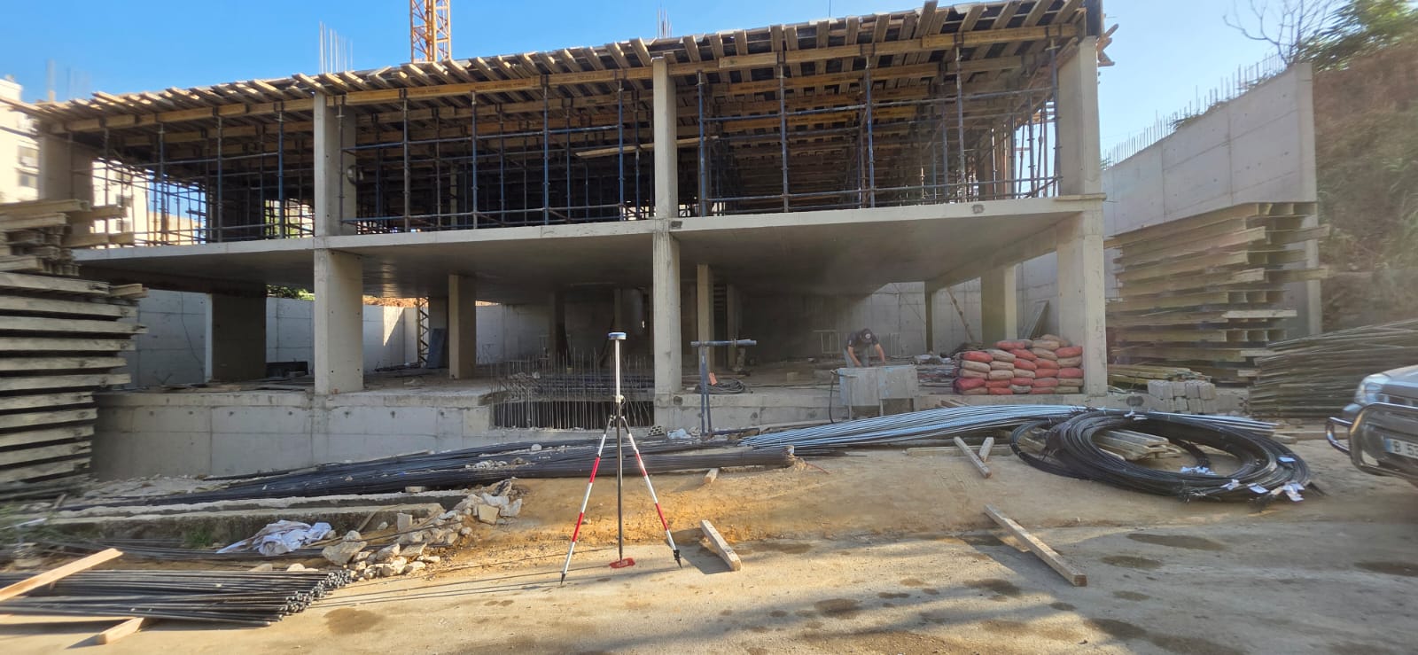
Building Topographic Check & Control
Building topographic verification and control surveys including foundation layout, elevation control, and as-built documentation.


Infrastructure Topographic Works
Comprehensive topographic survey of major infrastructure project for design planning and construction documentation.
Asbuilt & Survey Roads
Comprehensive as-built surveys and road surveying projects including existing infrastructure documentation, alignment verification, and construction monitoring.

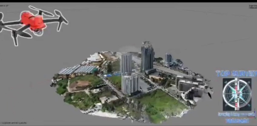
Coastal Development Orthomosaic
High-resolution aerial mapping of coastal development area producing detailed orthomosaics and 3D terrain models.

3D Model Creation
Drone-based aerial survey for 3D model creation including detailed terrain modeling and spatial analysis.
Project Categories
Our diverse portfolio spans multiple surveying disciplines and applications
Topographic Surveys
Excavation Topographic Survey Control
2016Precise topographic survey and control for excavation project including elevation monitoring, cut/fill calculations, and construction staking.
Building Topographic Check & Control
2024Building topographic verification and control surveys including foundation layout, elevation control, and as-built documentation.
Infrastructure Topographic Works
2015Comprehensive topographic survey of major infrastructure project for design planning and construction documentation.
Asbuilt & Survey Roads
2025Comprehensive as-built surveys and road surveying projects including existing infrastructure documentation, alignment verification, and construction monitoring.
Aerial Mapping Projects
Coastal Development Orthomosaic
2024High-resolution aerial mapping of coastal development area producing detailed orthomosaics and 3D terrain models.
3D Model Creation
2023Drone-based aerial survey for 3D model creation including detailed terrain modeling and spatial analysis.
3D Scanning Projects
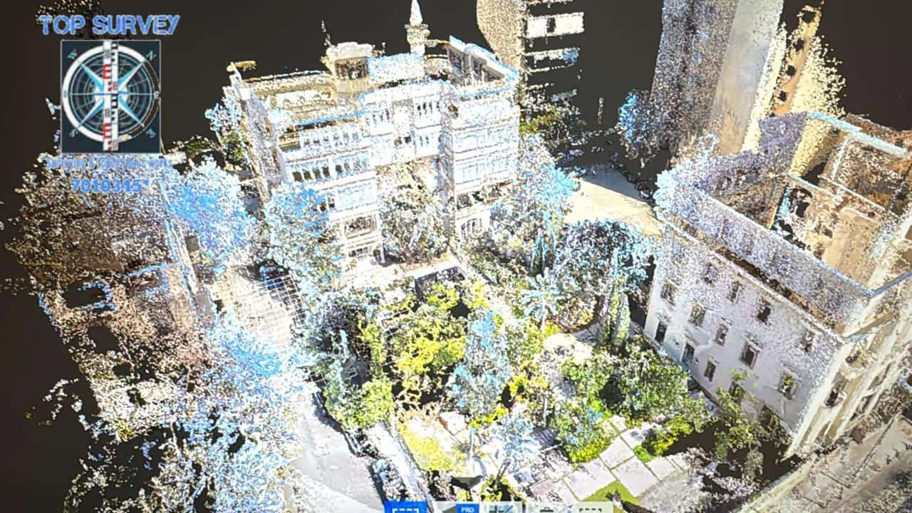
Heritage Building Documentation
2024Detailed 3D laser scanning of historic building for restoration planning and heritage preservation.
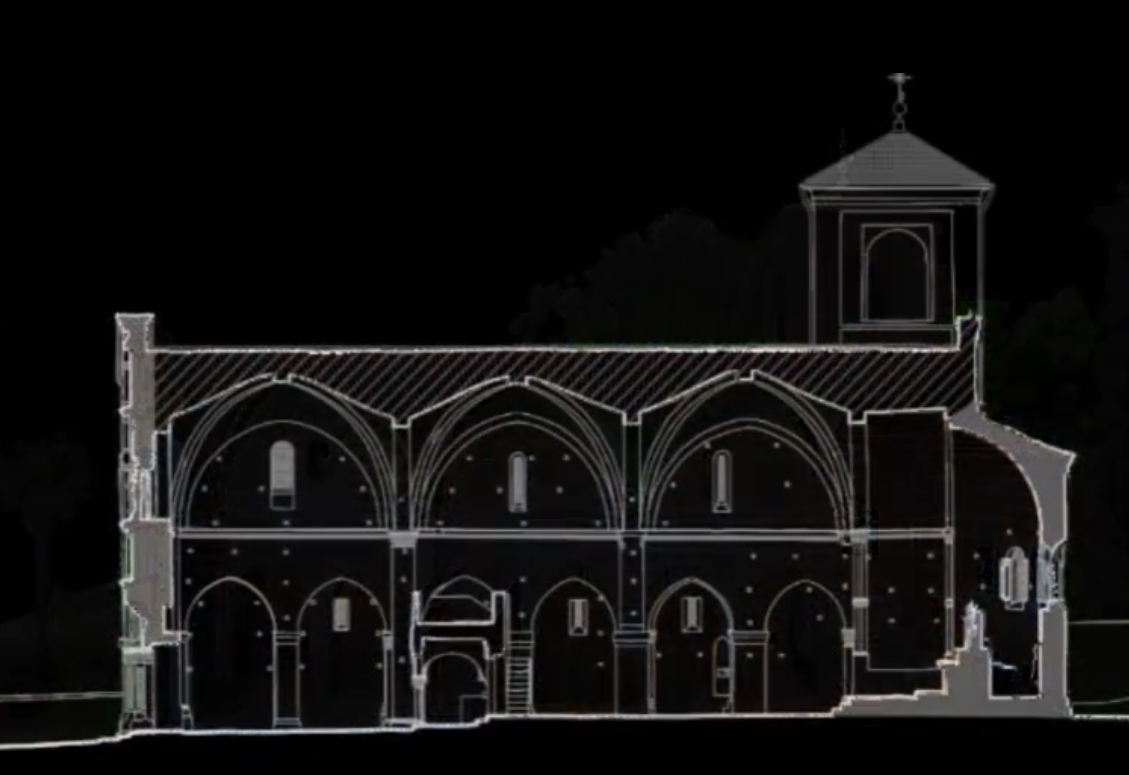
Facade & Section using 3D Laser Scanner
2024Comprehensive 3D laser scanning for detailed facade analysis and cross-sectional documentation of building structures.
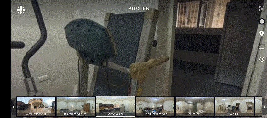
Reality Walk Through
2024Immersive 3D reality capture creating virtual walk-through experiences for architectural documentation and virtual tours.
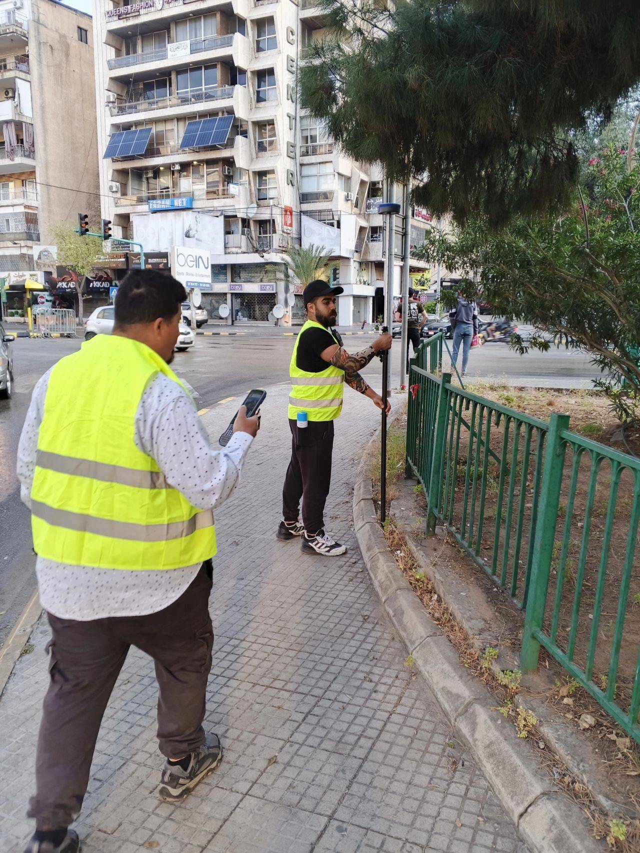
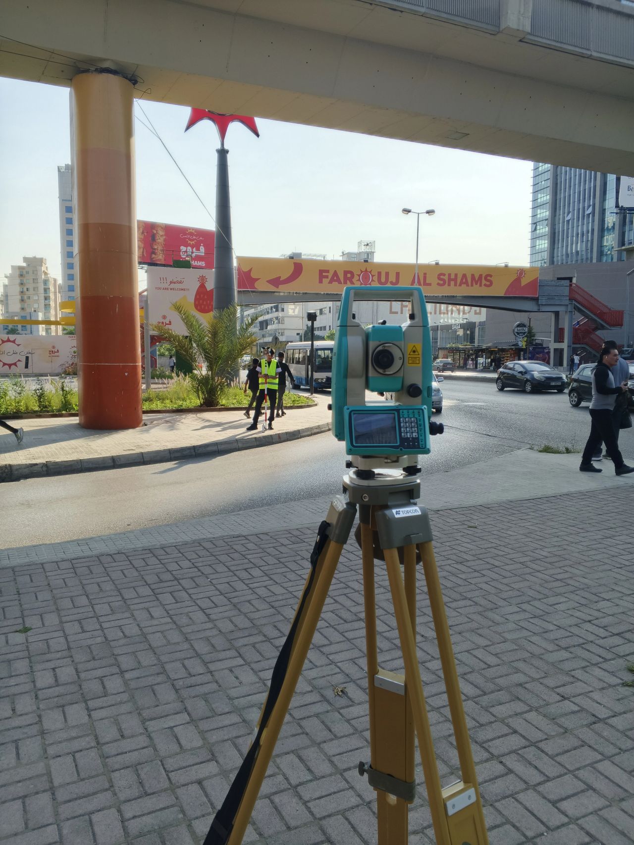
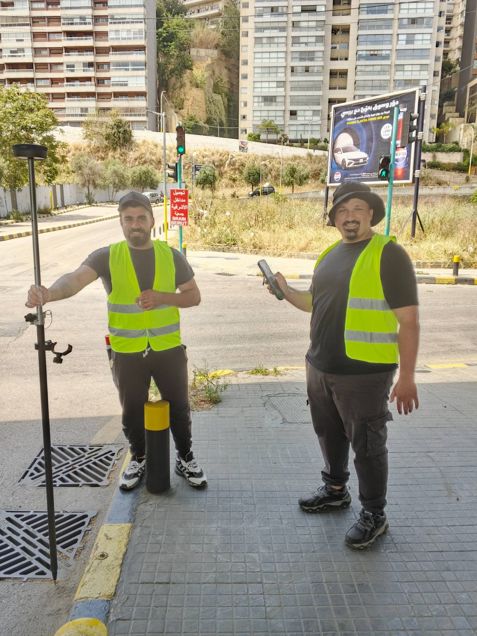
TOPSURVEY TEAM
Meet our professional surveying team equipped with advanced GNSS systems, total stations, and precision instruments, delivering accurate field measurements and comprehensive site documentation across Lebanon.
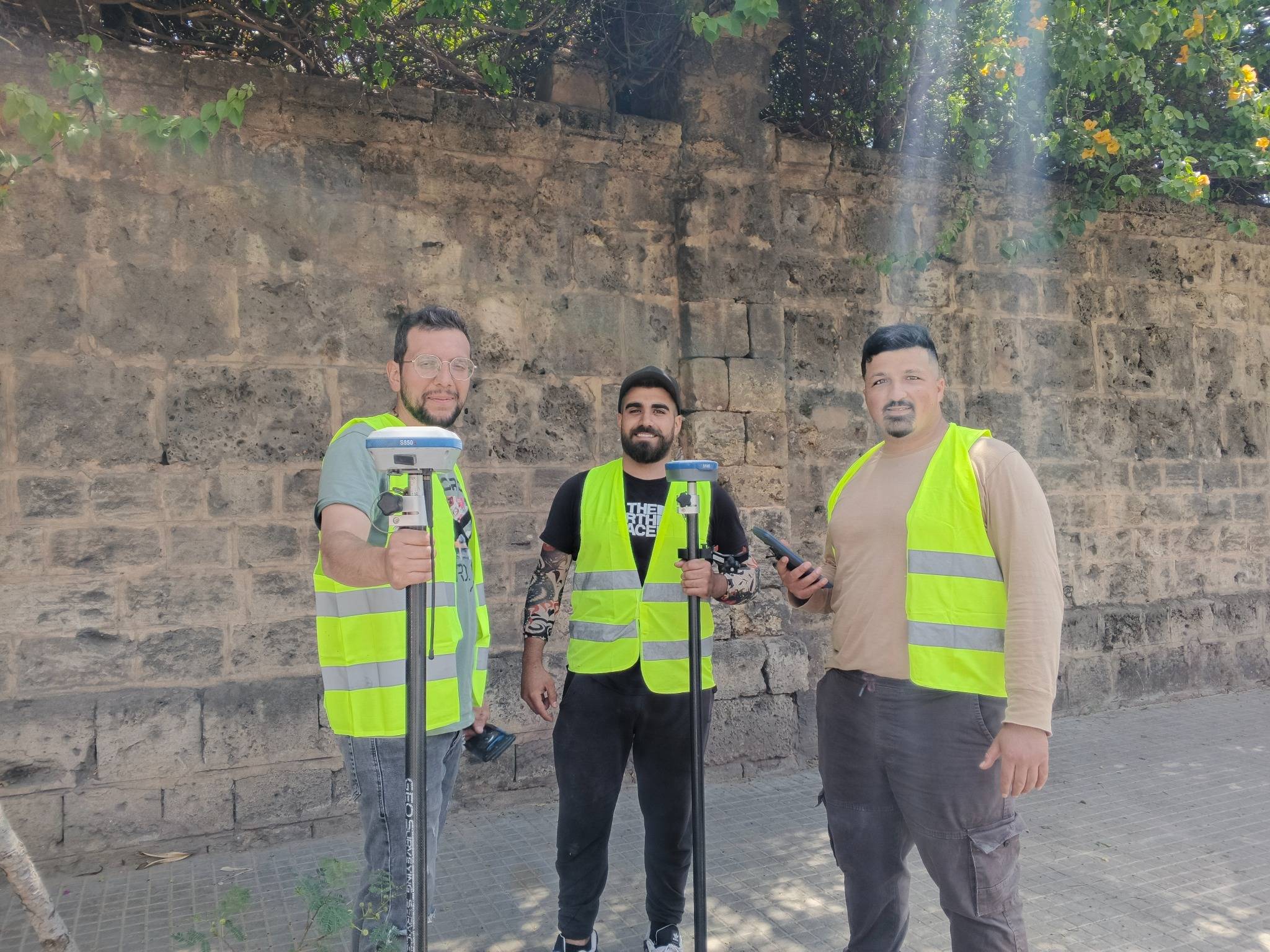
TOPSURVEY team preparing for field work with professional GNSS and surveying equipment for accurate data collection and site analysis.
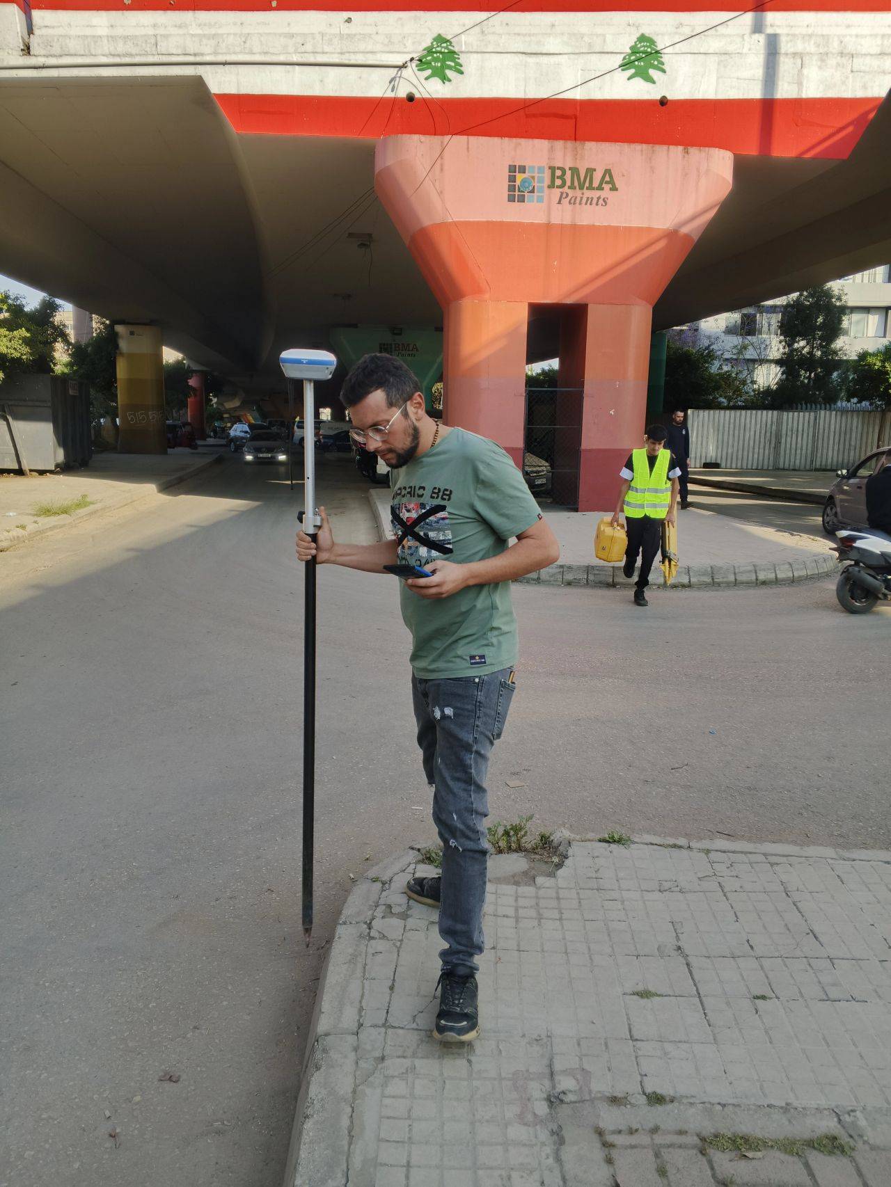
Professional surveying equipment in action, capturing precise measurements and data for comprehensive site analysis and mapping deliverables.
Start Your Project Today
Ready to see your project featured in our portfolio? Contact us to discuss your surveying and mapping requirements.